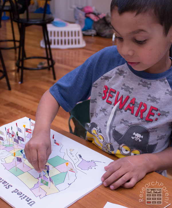
Geography is not my strong suit. I am determined, however, that the same will not be true for my kids. I’m going to do what I can to ensure that they don’t have to live their lives in quiet embarrassment, hoping that no one ever asks them to point out Delaware on a map. This homemade United States of America toothpick map is Step 1 of that process.
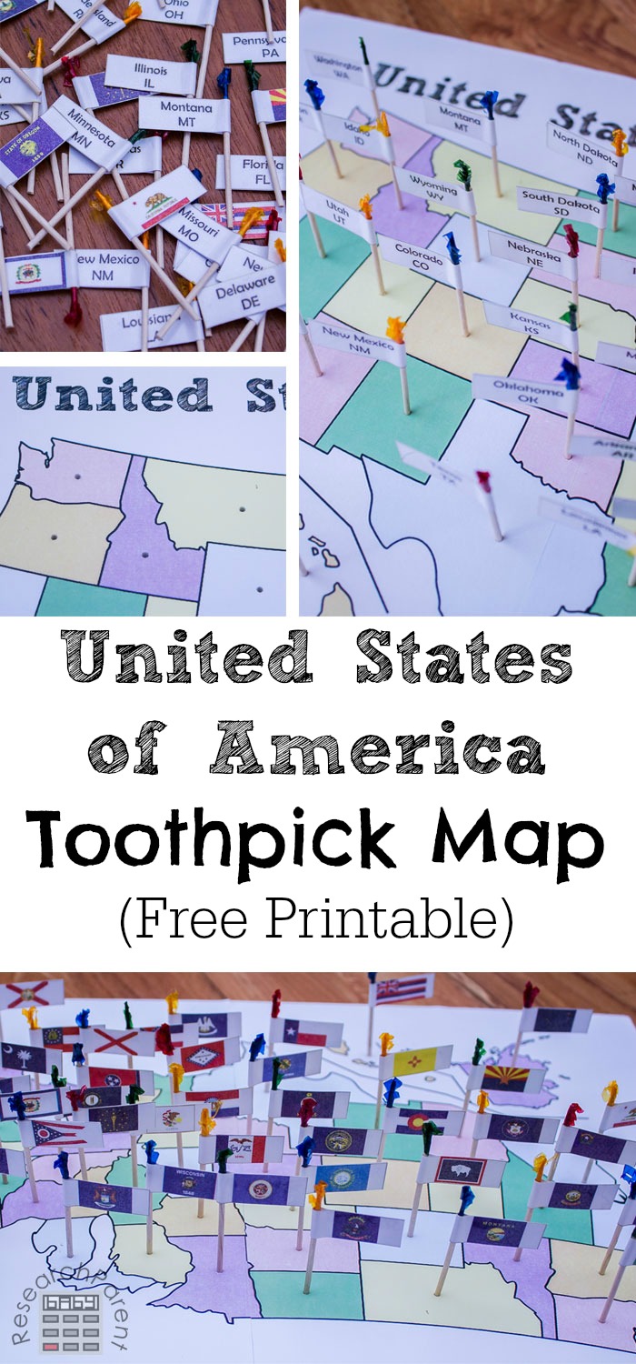
There are geography products on the market involving straight pins that look amazing (see for example Pin It! Maps), but I have two issues with these. One, I don’t trust my older kids not to leave straight pins out where my baby or toddler can find them. Two, those products are expensive and my hubby is ultra-frugal. It would be a hard sell to convince him to shell out that kind of cash on maps.

As an alternative, I decided to make my oldest this “toothpick map” for the United States of America, since that’s what he’s studying this year. (In case you’re interested, we’re using this curriculum (not an affiliate) combined with this Smart About the 50 States book. My son loves it. Learning about the states is one of his favorite parts of our homeschool day.)
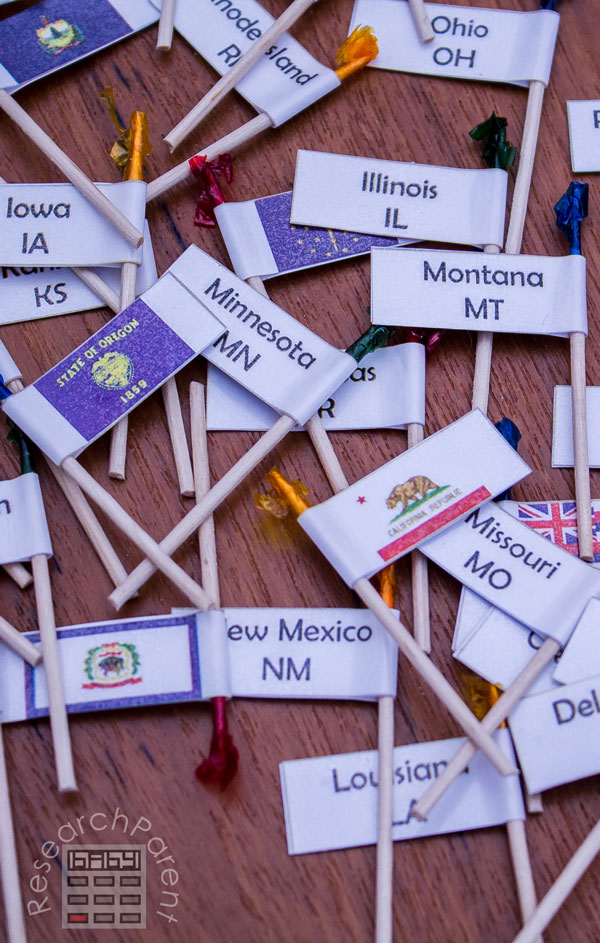
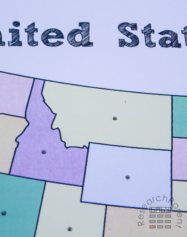
I particularly like using toothpicks for a couple reasons. First, they just seem safer to me than pins. I cut off the ends, so even if my baby finds one, he’s unlikely to hurt himself. Second, I can pre-punch all the holes into our foam board and they fit inside and stand up easily without having to poke different holes on each attempt. However, if you REALLY wanted to use straight pins instead with the flags/labels I made, I’m not going to stop you. They would also work.
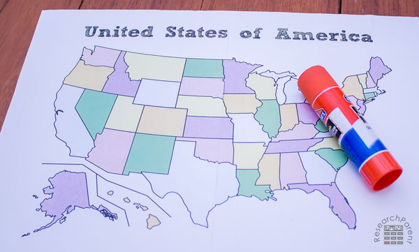
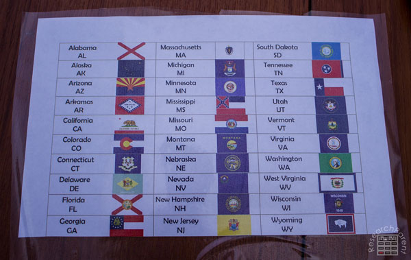
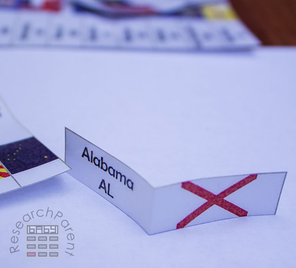
All the pictures in this post show the version I made, which is in color, but for your convenience, I also am including a black and white version in my free printable. Your kids could even color it in themselves. Just makes sure to match the colors of the states in the labeled and unlabeled versions in order to make identifying states using the control map easier. Also, I wanted my hands-on map to be bigger than a single sheet of paper, but not everyone might. You’ll notice in the printable that there are single and double page options for both the blank toothpick map and the labeled control maps. I chose to use the double size map for the toothpicks and the single page map for the control sheet which we use to check answers. Lastly, I don’t really care if my kids can identify state flags. I just want them to know where states are. However, for added fun, I put the state name on one side of the label and the state’s flag on the other.
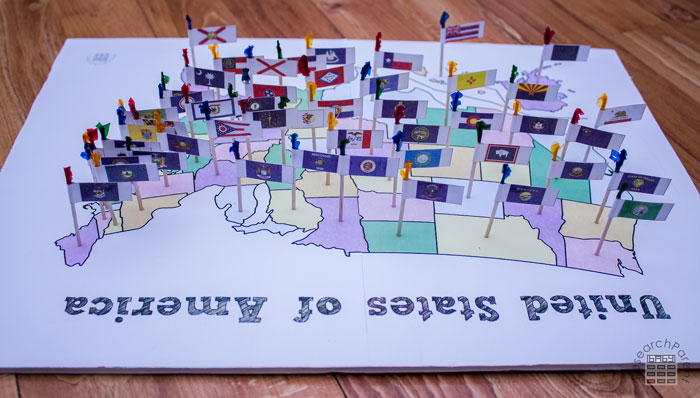
Now, I don’t want to sound like I’m bragging, but I’ve been using this map for the past day and on my last try, I got 46 states right. (Okay, my husband helped a little.) My son is also improving in his ability to identify where states are (though to be honest, he was already pretty good at it). Isn’t hands-on learning the best?
I fully intend to make toothpick maps for countries on each continent at some point in the not-too-distant future (I hope). Sign up for my newsletter if you’d like to stay in the loop with what I’m working on.
Recommended Age Range: Elementary, Middle School, High School, adulthood (for people like me)
Time Required: ~90 minutes (it does take some time…for older kids, maybe have them glue all those flags!)
Difficulty: Easy (initially I was having a little difficulty poking holes with my toothpick in the foam board, but I discovered a trick described below)
Cost: Free printable, a couple dollars for toothpicks and foam board
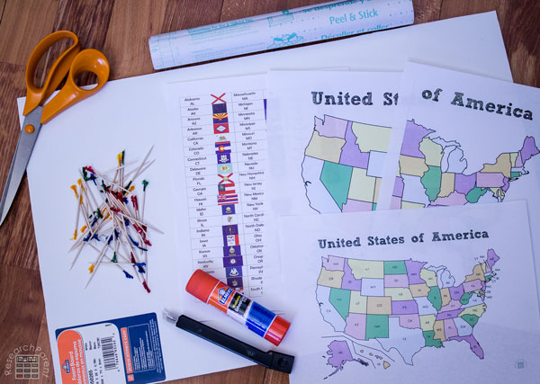
Materials:
- Paper for printing United States of America Toothpick Map printable (Note: you will not need all of these pages. See instructions.)
- a piece of foam board (no bigger than 17″x11″ is needed)
- contact paper or clear laminate (optional, for reinforcing labels on toothpicks…I used this)
Supplies & Tools:
- toothpicks (50 plus a couple extra for poking holes, just in case one gets bent)
- scissors
- X-acto knife (or other tool for cutting foam board)
- glue stick
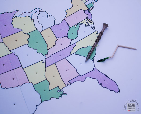
- nail or screw (not shown, recommended for starting holes in foam board)
Instructions:
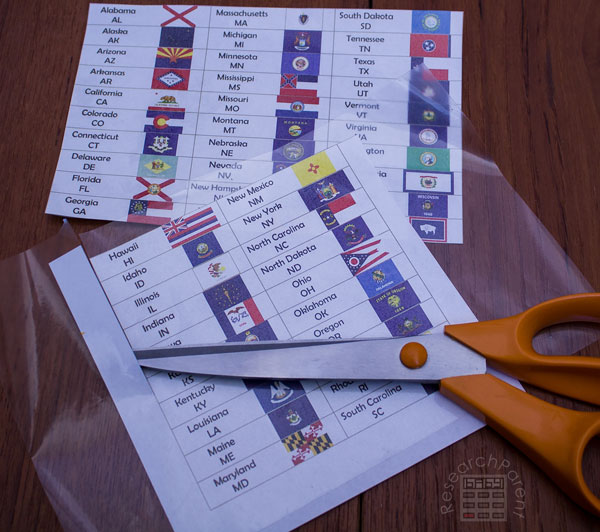
- Print out the desired pages from the United States of America Toothpick Map printable. You will definitely need page 1 which has the labels. I chose to print the colored, single page control map on page 2 and the colored, double-page blank map on pages 8 and 9. You may prefer to use only single or double pages and/or to print in black and white.
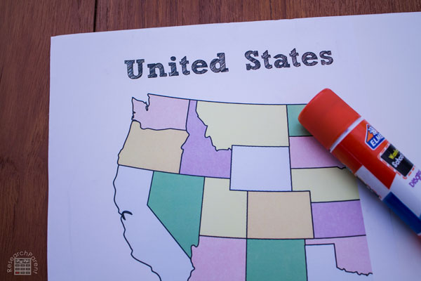
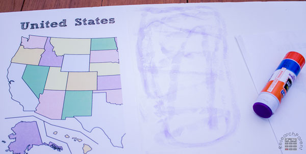
- Glue the blank map onto the piece of foam board. Since I used a double page map, first I glued the left page onto the corner of the foam board.
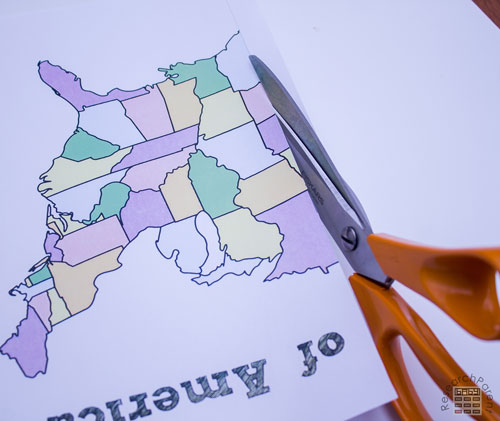
- If you are using a double page map, cut along the gray line to remove the extra paper from the right page.
- Apply glue to the foam board and the back of the paper.
- Line up the right hand paper with the left hand paper to make the double page map.
- Next, you will need to poke holes in all the states with the toothpick. I first started doing this by just using a toothpick. However, after breaking a couple toothpicks, I discovered this process was much easier if you used a sharp instrument like a nail or screw to start the hole before using the toothpick.
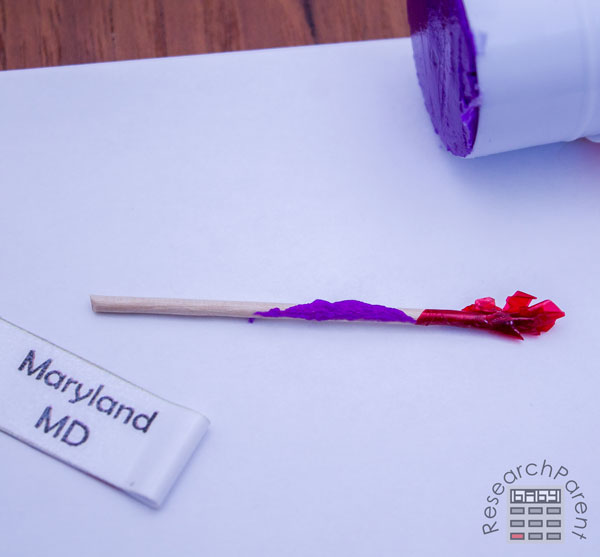
- Next comes the toothpick labels. I decided to use a piece of clear laminate to reinforce the labels to make sure they would last for all 4 of my kids. If you only have responsible children, you could probably skip this step. If you are going to reinforce them, make sure you only apply the covering to the top side of the paper.
- Cut out the flags.
- Fold each label in half.
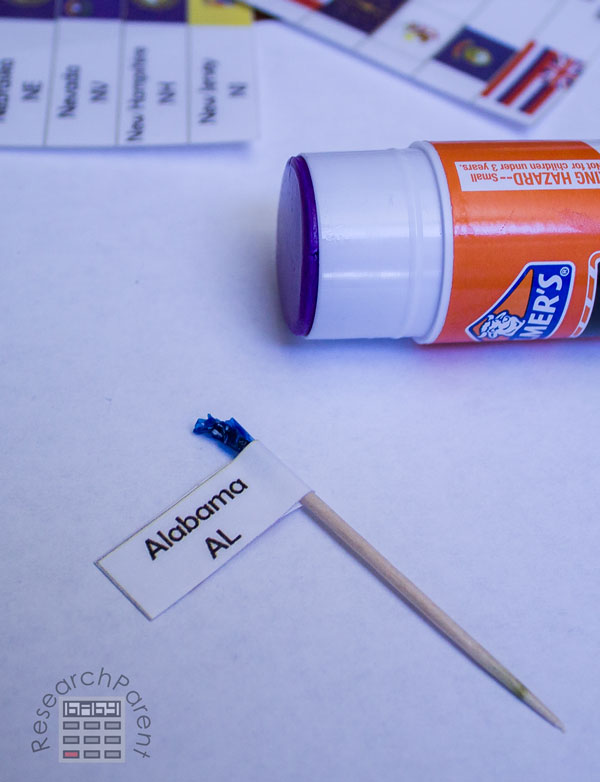
- Glue each label onto a toothpick.
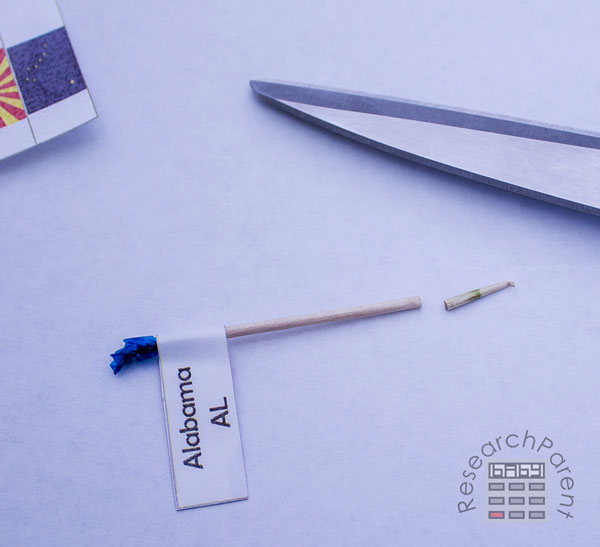
- Cut off the sharp end of the toothpicks.
- Insert all the toothpick labels into the appropriate states.
- If you haven’t already, cut around the paper on your foam board. I used an X-acto knife.
- If any of the labels come off the toothpicks when you are poking them into the holes, just apply some more glue to the toothpick and stick the label back where it belongs. This happened to a couple of ours the first time we used the board, but hasn’t happened since.
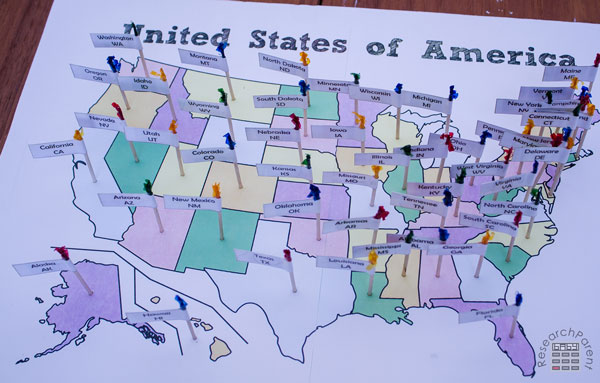
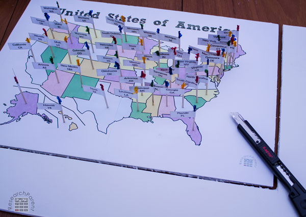
To use the United States of America toothpick map, learn about the states a few at a time. Smart About the 50 States is a good resource for this, particularly for children in early elementary. Give your child the flags for the states studied and see if they can remember where they belong. They can check their answers using the control map. Mistakes are totally fine! They can just try again next time. Once they become good at the states they’ve learned, gradually add more until they can remember the whole map.
Enjoy!
Click here for more Geography activities and printables for kids.
Related Links
History Activities for Kids
Social Science Activities for Kids
Government and Civics Activities for Kids


I absolutely love this! I’m using this as my daughter’s final project for learning the states. I love that It’s much more interactive than simply using flashcards. Bonus, I just happen to have all the supplies on hand, I only wish my toothpicks weren’t so plain. Thank you!!
I’m so glad you like it! I’m planning to do it with countries on each continent as well when my kids start learning geography outside the United States. I hope your daughter enjoys it!
Thank you so much!!! This is just what I was looking for!
I’m so glad you are able to use it! :)
For lack of better words – so awesome! Thank you! This whole site is gem! I really appreciate you sharing these wonderful works with us.
Thank you so much, Marla! I appreciate your kind words.
Are the labels editable? We are learning al the states and their capitals. Would like to have state/capital on flag vs the state flag and state name. Thanks.
They are not editable, I’m sorry! That is a great idea though! I will likely not have time to make updated labels until the summer, but I would love to make that an option.
This is simply awesome. The joy welled up inside my heart this Sunday afternoon when when i saw this resource. Tomorrow is gonna be a good day as I teach this lesson. Thank you sooo much. My students will love this.
I am so glad you can use my resource!