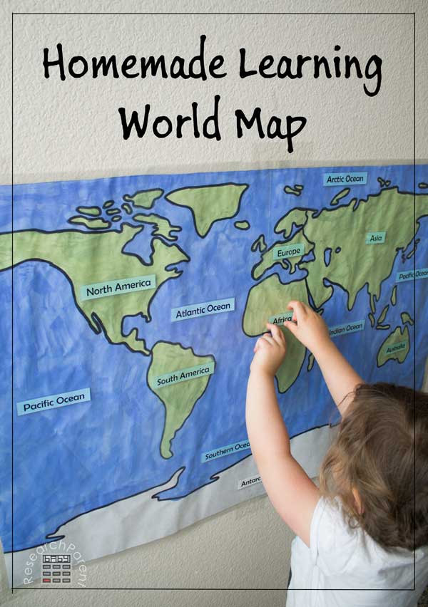
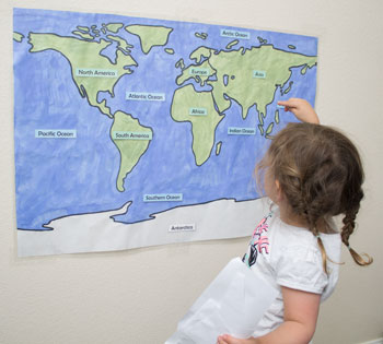
My 5 year old is currently very into maps which makes me happy seeing as how I have embarrassingly survived 3 and a half decades knowing little to no geography. He’s learning all the names of the continents and oceans in his Montessori school and is in love with the 90’s cartoon, Where on Earth is Carmen Sandiego (inexpensively available through this Amazon Affiliate link). I decided to support his love of geography at home through this homemade learning world map with labels that can be easily removed so he and his younger siblings can practice their reading skills and geography knowledge simultaneously.
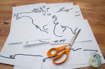
To make this map, I traced a wall map we already had, but since not everyone may already own a wall map, I’ve included a document which can be printed out and taped together to use as a template for tracing a wall map onto larger paper. I make no promises about the precise accuracy of this tape-together-world-map. It is exactly what I traced from my map, but I left out minor details for simplicity. I figure when my kids start asking me things like, “Hey Mom, why aren’t there any Great Lakes on here?” or “Where’s Hawaii?” it will be time to invest in a better professionally printed and laminated wall map. For now, this inexpensive, homemade one is entirely sufficient.
Recommended Age Range: Preschool, Kindergarten, Elementary
Time Required: ~2 hours (It took me a bit longer, but I had a 1 year old “helping.”)
Difficulty: Moderate (Hardest part is using the contact paper to “laminate” the large sheet of paper to make the labels easily removable. Could also just apply a strip of packing tape where you want the labels to be placed (or write the labels directly onto the map, which would be easiest, but remove the “interactive” feature.)
Cost: Less than $5 in used supplies
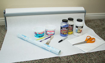
Materials:
- A large piece of paper such as butcher paper (my map is 32″ by 21″)
- Blue and green paint (I used powdered paint in blue, yellow, and white to mix the colors I wanted)
- Paint brushes
- Containers to hold paint (such as old food containers)
- Contact paper
- Paper (for printing a tage-together template map if needed, ocean/continent labels, and a control map for comparison)
- Tape (optional: only if you need to make the template map and for “playing” the game by taping the labels to the laminated map)
Supplies & Tools:
- Black marker
- Printer
- Scissors
- Laminator and laminating sheets for labels (optional: could use contact paper)
- Paper trimmer (optional: makes cutting out laminated labels easier)
Instructions:
- Print out, cut out, and tape together the tape-together-template-world-map if necessary.
- Trace the template map onto the large sheet of paper using a black marker.
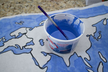
- Paint the continents green and the ocean blue, then let it dry.
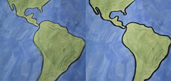
- Outline the continents in black again if desired.
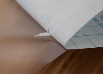
- Trim the borders of the paper if desired and “laminate” the map using contact paper. Note that this was the hardest part in my opinion. I used a large board game box to mark with a pencil where I wanted to trim off excess paper and to make sure I had right angles on my corners. Also, it can be difficult to peel off the backing to such a large sheet of contact paper, so it’s helpful to have a helper. For me it was my 5 year old. If the backing starts to tear as shown in the picture below, make sure to fix the problem right away by peeling up the stuck piece. Since my map was bigger than a single sheet of contact paper, I used two pieces on each the front and the back, making sure to overlap them slightly since the contact paper did not stick firmly to my powder paint.
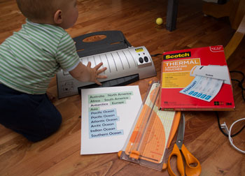
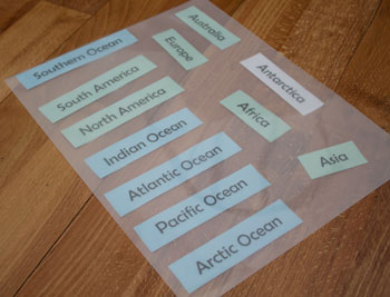
- Next print out and cut out the continent and ocean labels.
- Laminate the labels using either a laminator or contact paper and cut them out.
- Tape the map to the wall at child height.
- Print out a control map so that the child can determine on their own where each label should go.
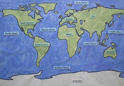
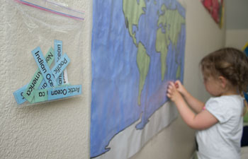
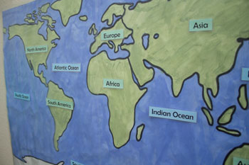
- When your child wants to play the “game”, help them roll up tape to stick on the back of the labels to place them on the map (or use double-sided tape). For younger children who are not yet reading, tell them what the labels say.
Click here for more Geography activities for kids.



Oh, I like that! I just started reading my 4 year old the Montessori Map Work board book every day in an effort to teach her the continents.
Thanks! I hadn’t heard of those books before, but they look interesting. At my kids’ Montessori preschool they trace the continents from a puzzle to learn the names. Since we’re planning to homeschool next year, I’m hoping to see what I can come up with to replicate that as well. Thank you for stopping by!
I love this, especially since it is hand made! Thank you for sharing the printable too. I’d love to teach my son at least some basic geography using this.
No problem! I hope your son enjoys learning some geography. My son has been interested in continents, oceans, countries, etc., since was 3 or 4, but my current 3 year old still doesn’t really have any interest. I’m hoping to help her learn her address at least soon though, though this map probably won’t help with that. :)
Thank you so much for practically putting together this lesson for us. Its amazing, you really helped me!!!
I’m so glad you are able to use it! You are very welcome. :)
Great idea and beautiful result! I think I’ll print this out for my kids and have them paint it (do I dare?) Lucky for me, our local teacher supply store has a self-serve laminating machine for a ridiculously cheap price (way less than a copy shop).
A self serve laminating machine! I’ve never heard of such a thing. I think my heart just skipped a beat.
Holy cow, that is amazing! When it comes to that amount of work, I just buy it, ha ha. Not that I don’t enjoy it, I just don’t have the time! You did a phenomenal job! I already have a featured post this week but I am going to schedule this to share on my FB page, it is really a great resource!
Thanks for linking up at Favorite things Friday! Hope to see you again this week!
Thank you so much! When I made it, I wanted the ability to have a blank map with removable name labels to make it interactive. Also the laminated map I was looking to purchase online was $30. However, I was at Costco the other day and saw they had really nice laminated maps for about $10. For that price, I totally would have just covered up the names on the professional version! Oh well, I had fun making it anyway.
This is fabulous – planning to feature on Monday! My kids love those Carmen Sandiego cartoons too (we also purchased them via Amazon).
Wow! Thank you SO much. I’m honored. I hope you’re having a great weekend!
This is great!
However as an Australian I _was_ forced to add Tasmania and New Zealand:-)
Sorry about that! I need to work on my tracing skills for next time. :)
(On the plus side, you have at least included Australian examples for your land/water forms, which is useful:-) )
Hmm… was just looking for Korea, and identified another error—which if you do corrections at all, you _might_ want to fix up! There’s an island shown between Korea and Japan (I had thought you’d shown 4 islands for Japan)… but I _think_ that island should be added to the mainland—because it’s actually South Korea!
(Full disclosure, I was just watching one of those ‘Americans and their Geography’ videos, and _many_ people were identifying Australia as Korea [because it was labelled as such, and they obviously didn’t know where they should be looking], so I went to make sure _I_ knew where I should be looking:-) And found that it didn’t look quite like I expected!)
But we _love_ this map! The 4yo will look across and ask questions about what he sees (and can point out where we live), and even the 11yo looks to it as his first port of call when he wants to know where something’s happening:-)
I can’t tell you how much I appreciate you catching my mistakes and letting me know about them! I’m going to see if there’s a way for me to at least fix South Korea and hopefully add New Zealand and Tasmania without retracing the whole thing. I’ve always been terrible at geography, but I’m working on it. I’ll let you know when I’ve updated it. Thanks again!
No worries at all:-)
(The only other major change I made is the British Isles, and separating Ireland from Great Britain.)
Well, it took me FOR-EVER, but I finally got around to fixing South Korea and separating Ireland from Great Britain. I just touched it up digitally instead of going back to re-trace, so I haven’t added Tasmania or New Zealand yet unfortunately. Thanks so much for correcting me! I really, really appreciate you helping me cover up my ignorance. :)
What a great idea! Thanks for sharing, this looks like a really fun way to learn the world.
You’re welcome and thank you! I’m glad you like it. :)
I thought the map pieces would be a good puzzle for my 6 year old to put together and colour. My older children could do the same and add more detail. Thanks for the great resource. :)
No problem! That’s a great idea to treat it like a puzzle. I might try that with my preschooler. :)
Dazzled with your site and amount of shared treasures. Thank you so much !!
Are you interested in translating into Portuguese and sharing in Brazil?
Please say yes!
Thank you! I would definitely be interested one day, but probably not in the near future. There are too many things I want to do and too little time! When my kids are older, I would love to translate and share my resources in other languages.